
Bridge Simulator ARPA RADAR - General Features of Navigation / Watchkeeping Simulator
The image system will be capable of rotating the image horizontally 360 degrees, changing the vertical view of the image up and down, and rotating the image from the virtual bow direction to the bridge swallows.- The image system will provide twilight, night and day conditions in accordance with the training purposes.
- The image system will include wind-related sea conditions, clouds, fog, rain, night stars, tide level, bow and stern hit buoy wakes, global world model and ground structure features.
- Special lights for buoy systems (IALA System A and System B), navigation lights and navigation auxiliary lights sectors and flashes will be interchangeable.
- The image system showing 1 horizontal image area on the bridge will be provided with an LCD projection system. This system should be expandable up to 11 views (windows) if desired.
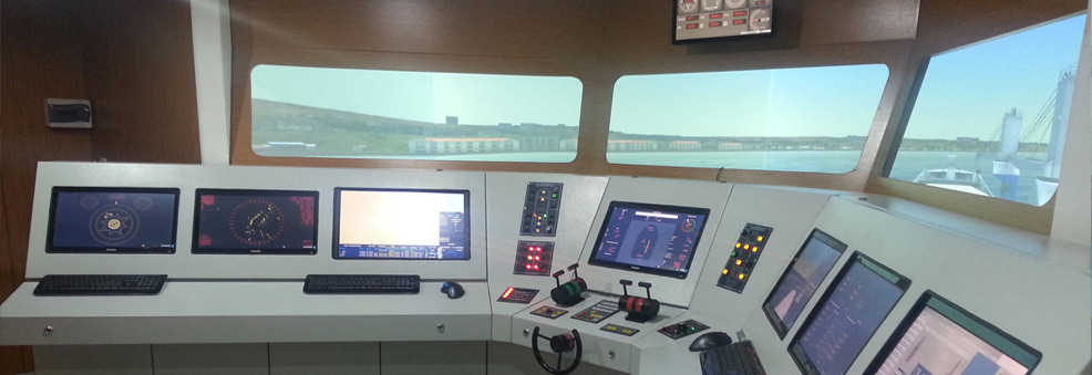
- The maneuvering and steering control consoles on the bridge will be equipped with the equipment required for navigational controls of a classic and modern ship.
Ship maneuvering controls will include the following features;
On the computer screen;
Ship's direction indicator (Gyro Repeater)
Ship's speed, speed meter (Longitudinal Doppler Log,)
Turn ratio indicator
Rudder sensor
Propeller RPM and RPM/Pitch adjustment
Air pressure start indicator
Wind direction and speed (Relative and true) indicator
Depth indicator GPS Fix (Latitude/Longitude) indicator
Interactive navigation lights and anchor control panel
On the maneuvering console;
Twin engine telegraph and RPM/Propeller
Pitch control Steering control system including manual helm control,
FU/NFU and automatic helmsman functions
Bow and stern maneuvering propellers control
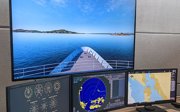
ARPA RADAR Screen;
- ARPA RADAR screen will simulate real devices and meet IMO requirements. It will be a modern color scanner type on the bridge and will include navigation functions. ARPA RADAR console will comply with IMO rules (A-477, A-48, A-823) in terms of its functions.
- Radar will have features to be used in X/S band operation, relative movement in the heading or north direction, real movement and ARPA functions.
- ARPA RADAR Simulator will be able to show digital coastline creation with ship control navigation structures, SART signal, Racon, Shadow sector, Reflection effect, False echoes, Roll and side lobe effects, Multi-reflection echoes, Radar interference, Creation of effects on different pulse lengths and widths, effects created by different antenna rotation speeds, sea and rain effects.

Instructor screen;
- The trainer unit will have the flexibility to select and control the following events before and during the scenario application. These events are; Scene and image creation system (visibility, fog, sunlight) Environment (wind, current, sea, depth, shallowness etc.) Traffic (types of sailing ships, turning points, routes etc.) Radar echoes Ship features Navigation aids
- The database management system will have the ability to create new scenarios and organize data for a ready scenario.

2. Bridge Station;
-A second bridge will be created in a computer environment. The features specified in the above items will be simulated on this bridge.